
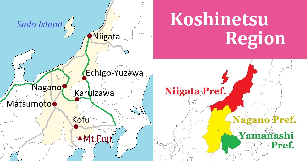
Koshinetsu Region [甲信越]
Outline of Koshinetsu Region
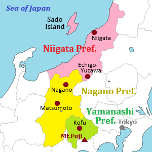
Koshinetsu Region is near the center part of Honshu Island in Japan.
(The first "o" in "Koshinetsu" is pronounced long, and "n" and "e" are pronounced separately.
So it is read as "Kōshin-etsu" in Japanese.)
This region is generally mountainous, and its central part is the highest-elevation area in Japan.
A few major mountain ranges run from north to south and they are often calls Japanese Alps.
Especially, the mountain range on the west side of the region has several celebrated mountains and many climbers visit there.
Apart from these mountains, there is well-known Mount Fuji (3,776 m) at the south edge of this region as an individual mountain.
Roughly speaking, Japanese Alps divides Japan into east and west.
Koshinetsu region belongs to the east Japan side.
Because of the high mountain range on the west side, Koshinetsu region has a strong tie with adjacent Kanto region including Tokyo.
So, main railway lines and roads lead to Tokyo.
Many cities and towns are on the basins and highlands.
It is cool and comfortable in many resort areas in summer.
And, in the northern area, much snow fall in winter and there are many ski resorts.
This region has three prefectures: Yamanashi, Nagano and Niigata.
Each prefecture has well-known agricultural products.
Grape and wine in Yamanashi Prefecture are famous.
Buckwheat noodle and apple in Nagano Prefecture are popular.
Rice and sake in Niigata Prefecture are very tasty.
Guide of each prefecture in Koshinetsu Region
Yamanashi Prefecture
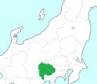
Yamanashi Prefecture is located just west of Tokyo Metropolis.
And, it is located north of Shizuoka Prefecture with Mount Fuji towering along their border.
Mount Fuji is located about 100 km from Tokyo and can be seen in the distance from the Tokyo metropolitan area.
In the southeastern part of Yamanashi Prefecture, the vast foothills of Mount Fuji stretch out.
There are five lakes known as "Five Lakes of Fuji" including Lake Kawaguchi and Lake Yamanaka throughout the area.
There is a basin in the center of the mountainous prefecture.
Kofu city, the prefectural capital, is in the basin.
In the 16th century, a powerful warlord named Takeda Shingen appeared from this area, and he is still known today as a hero of Yamanashi Prefecture.
This basin is Japan's leading grape-producing region, so you can see many vineyards here.
In particular, Katsunuma town is the center of the area and is also a popular tourist destination.
A mountain range with the peaks ranging from 2,000 to 3,000 meters in elevation runs along the western border of the prefecture.
It is one of the Japanese Alps and is known as Southern Alps.
Nagano Prefecture
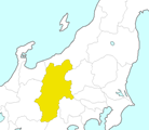
Nagano Prefecture is located roughly in the center of Honshu island.
It is an inland prefecture, and there are many mountains and some basins.
In particular, there are three major mountain ranges known collectively as the Japanese Alps that stretch across the country, consisting of the peaks ranging from 2,500 to over 3,000 meters in elevation.
Basins and plateaus stretch out among these beautiful mountain ranges.
The entire prefecture feels like a mountain resort.
Nagano city, the central city of Nagano Prefecture, is located in the northern part of the prefecture.
The surrounding mountainous region receives heavy snowfall in the winter, so there are several popular ski resorts.
The eastern part of the prefecture is dotted with many highland resorts, including Karuizawa.
In the western part of the prefecture, Northern Alps mountain range rises like a wall from north to south.
This mountain range separates western Japan from eastern Japan.
Famous peaks such as Hakuba, Tateyama, Hotaka, and Norikura are clustered here, making it a popular mountain region among the alpinists.
Matsumoto city located at the foot of the mountains is the regional hub and is known for its beautiful Matsumoto Castle.
In the southern part of the prefecture, Central Alps and Southern Alps run parallel to the Northern Alps, and the rivers flowing between them have carved out deep and long valleys.
One of the valleys is the Kiso Valley, and it was the inland route connecting Edo and Kyoto in ancient times.
So, the historic post towns such as Tsumagoand Magome still remain.
Niigata Prefecture
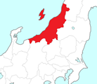
Niigata Prefecture is a prefecture along the Sea of Japan, and is located in the north-northwestern direction of Tokyo.
The coastline is long and the length is about 260 km.
Its length is comparable to the straight-line distance from Niigata to Tokyo.
In winter, snow falls throughout the prefecture, and the mountainous areas in particular have heavy snowfall.
The prefectural border is mostly on the steep mountains.
On the border with Gunma Prefecture, there is the dividing ridge between Sea of Japan side and Pacific Ocean side of Japan.
There is Echigo-Yuzawa town, and it is an area with several popular ski resorts.
There is a plain along the coast in the central part of the prefecture, and there is Niigata city which is the main city in the prefecture.
Niigata Prefecture is well-known for rice country.
Rice cultivation takes place across a wide area, centered on this flatland region.
Because good rice is produced, sake is also tasty in Niigata Prefecture.
Niigata Prefecture has the most sake breweries in Japan.
Sado Island is located in the Sea of Japan off the coast of Niigata city.
It was once a place of exile, but when gold mines were opened there in the 17th century, it became an island that played a vital role in supporting the economy of the Edo shogunate.
Here, you can experience its unique culture.
Transportation in Koshinetsu Region
Airport
A main airport is Niigata Airport.
It has some international flights and domestic flights.
The domestic flights are operated between Shin-Chitose (Sapporo), Narita (near Tokyo), Chubu (Nagoya), Itami (Osaka), Fukuoka and Okinawa airports.
It takes 25 minutes from central Niigata city by route bus.
There is another local airports in Koshinetsu Region.
It is Shinshu-Matsumoto Airport, and is located near Matsumoto city in Nagano Prefecture.
It has the flights between Shin-Chitose (Sapporo) and Fukuoka only once or twice a day.
Railway
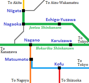
Main railway lines of JR in Koshinetsu Region.
The colored lines are the route of main limited express. Thin grey lines are local trains.
Shinkansen train comes from Tokyo to Niigata area and Nagano area.
The trains are operated once or twice an hour.
By the fastest train, from Tokyo, about 1.5 hours to Niigata and Nagano.
By Limited expresses of JR lines, about 1.5 hours to Kofu, about 3 hours to Matsumoto from Tokyo.
And, from Nagoya, about 2 hours to Matsumoto, about 3 hours to Nagano.